
Wide World Maps & MORE!
Topographic Map Symbols (Science for a Changing World)
A vital reference to know what the symbols are on standard topographic, topo, or contour maps. This is a comprehensive full-color four-page symbol sheet of ALL symbols used on the maps. Very handy for hiking, four-wheeling, hunting, prospecting, or any outdoor activity where these maps are used.
Interpreting the colored lines, areas, and other symbols is the first step in using topographic maps. Features are shown as points, lines, or areas, depending on their size and extent. For example, individual houses may be shown as small black squares. For larger buildings, the actual shapes are mapped. In densely built-up areas, most individual buildings are omitted and an area tint is shown. On some maps, post offices, churches, city halls, and other landmark buildings are shown within the tinted area.
- 4 pages
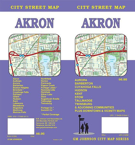
![Akron / Summit County, Ohio Street Map [Map] GM Johnson - Wide World Maps & MORE!](http://maps4u.com/cdn/shop/files/61ADgXzTERL_c25aac2b-d572-47c4-9574-5bfbd5e6ebed_large.jpg?v=1714540277)
![Home Below Hell's Canyon [Paperback] Jordan, Grace - Wide World Maps & MORE!](http://maps4u.com/cdn/shop/files/61_la_Wsc3L_8e2fe30d-fce9-4597-8019-9d8b3c90eeb7_large.jpg?v=1714540264)